What a glorious day Revelstoke put on for us-the sun was shinning.
We stayed at the Lamplighter Camping Ground, a fairly small RV Park. It is run by a lovely couple from Switzerland. Amenities are quite basic; 2 washing machines, 2 dryers but we have Wi Fi and Cable TV but the view more than makes up for it.
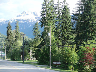
Mount Boulder frames the Lamplighter Office.
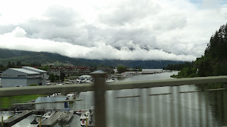
View of the mountains taken from inside Al
(short for Alpenlite which is the make of our 5th wheeler).
Another shot of this spectacular view from Al - I couldn't help myself, it was such a gorgeous day. Check out the tubular looking caravan - its called an Airstream made from polished aluminum.
Our truck and Al. Unfortunately the tail lights on Al were still giving problems.
Went for a walk at around 7.30pm, sun still shining.
Mount MacPherson.
The mighty Columbia River starts in the Canadian Rockies and runs all the way down to Oregon, USA. The total river basin of the Columbia is the size of France.
Word was out - the Revelstoke Dam Spillages were open!
We took a self conducted hour tour of the BC Hydro.
What a magnificent sight! The Revelstoke Dam is built on 3 of the First Nationals lands - the Okanagans, the Shuswap and the Ktunaxa tribes.
Due to the unusual high rainfalls, the Revelstoke Reservoir was near to full,hence the release of the excess back into the Columbia. This Reservoir is about 81 kms long.
As the Columbia crosses into America, the USA, Canada and the Province of British Columbia signed a River Treaty in 1964. The Treaty coordinates flood control and electrical energy production in the Columbia River Basin.
An impressive sculpture to welcome visitors to Revelstoke.
Above 2 pics of downtown Revelstoke.
City Hall, Revelstoke
Houses line the banks of the Columbia.- with Mt MacPherson in view.
Couldn't work out what the dome shaped building was.
The Canadian Pacific Railway - we counted 123 carriages on one of them. This one is crossing the Columbia.
This single lane bridge was only a stone's throw from our RV park.
Another view of the Columbia as it thunders its way to Oregon. It is a very fast flowing river!
Three Valley Lake is fed from the glaciers, so its a freshwater lake.
 The Chateau is situated at eastern end of the lake. We were there today and we could see the lake water lapping on the footpath-we were told it is receding.
The Chateau offers a charming restaurant and quite a large Gift Shop (not that I had time to peruse it!)
Tom looking like a Cheshire Cat!
Me in my "fat girl" clothes.
The Railway plays an important part in this area of Canada, there a substantial Railway Museum in Revelstoke.
Spotted these unusual flowers at the Chateau.
A pretty lilac and white combo.


What a spectacular view from your 'Al'. Hope your tail lights get sorted out for you. It was raining here in North Dakota a few minutes ago, but out the front of our RV at the moment I can see a glorious rainbow. Murray is out on the lake fishing - I daresay he and his mate will be wet!
ReplyDeleteYou two sound like you're having a great time. We wish you well. Think you could incorporate a MAP with your travels. Be nice to know where theese places are, without looking them up that is. Warren n Kathy
ReplyDelete